Sponsored By OFFZGRD Partner:
Metal Cloak’s Modern Jeeper
The orange sun just dipped below the razor-sharp ridgeline and I haven’t even aired-down yet because I’m racing to get to anywhere I can call “camp” before twilight vanishes. It’s a very familiar story – one I swear I’m done telling. And yet, here I am, following random waypoints I set months ago during one of my 3A.M. map-making sessions. But that severely washed out section just ahead reminds me I better take a minute to ditch at least 15psi before a shredded side-wall sidelines this epic road trip. One thing is for sure, you can’t get to places like this without a few veteran overlanding secrets…
By their very nature, Jeeps entice you to explore new places and take roads less travelled. But in today’s digital world filled with social media and just about a million off-roading maps resources and blogs (like one of my favorites, trailsoffroad.com), even the most rugged of roads seems to be well, highly trafficked! And that’s why we go to these places – to get away from the traffic.
Once upon a time, much like developing photos in an actual darkroom, “4x4’ing” required real skill – at least in terms of navigating uncharted territories. Yes, people had to actually look at paper maps and take a wild guess what kind of trail they’d likely be on by deciphering the topography. These days you can just log onto YouTube and search something like “Monache Meadows Jeep Trail” (Courtesy of: Overlanding USA) for example. (Insider’s Tip: By the way, if you live in CA and own a Jeep, you have to go check that place out!)
Don’t get me wrong, I’m happy to share the great trails I’ve found and still give the requisite two-fingered “Jeep wave” to every other mud-caked Wrangler on the freeway. But when it comes to getting @OFFZGRD, I always prefer to pick my own paths. So how do I do it? Great question – I have to figure that out every single time I fuel up! The simple fact is about 3 out of 4 roads I target as potential “points-of-interest” in my library of waypoints are complete duds. They’re dead-ends, locked gates, washed-out or just simply boring. But the dedication to details does pay off and in some cases, in a really big way. No matter what, my goal is always the same: Find the road nobody else is on.
Here are a few easy tips and tricks
to finding your own little piece of off-grid paradise:
@OFFZGRD Tip #1: Never fear the unknown! > Even if you have no idea how you’re going to get somewhere, embrace adventure. In fact, almost every single time I hop in my Jeep, the only destination I have in mind is the final one. How I actually get there and where I stay along the way is often a total mystery. That said, just driving around aimlessly looking for cool roads is only going to empty your gas tank – and your wallet. As we all know, JEEP actually stands for “Just Empty Every Pocket” so whenever you can, have a plan – even if it’s a loose one.
In this case, I’m headed up to my college buddy, Bob’s cattle ranch for a week-long trip to Lander, Wyoming. Driving from Southern California may seem like a daunting task to most, but to an overlanding Jeeper (@overlandjournal) like me, it’s a real recipe for adventure because I know that between here and there, there are some sweet backcountry gems just waiting to be discovered!
@OFFZGRD Tip #2: Allow yourself the luxury of extra time to explore. > Just because you have to be at a certain place at a certain time doesn’t mean you have to stress yourself out getting there. We all have hours to keep and jobs to do, but in our modern lives, we too often trap ourselves with very specific timelines – 14h16m to be exact if I’d planned to drive directly. But what fun would that be? So instead, I planned an extra day buffer on either end of the trip to let my BFGoodrich KM2 mud-terrains roll wherever they decide.
General Google Maps Search: “OHV Off Road Trails Utah”
@OFFZGRD Tip #3: Ditch your digital device & Navigate OFFline!) > It’s easy when going from point A to B to simply plug your destination into your smartphone and let The Google lead you around on a digital leash. Or, you can do it the old fashioned way and plan your own route - manually. Obviously, driving from California to Wyoming, I have to pass through Utah. (Don’t threaten me with a good time!) A simple Google search of “Utah OHV areas” (Courtesy of: treadlightly.org) may seem like a good choice, but in fact it’s just the opposite.
Chances are, if you find a designated OHV area with SEO (search-engine optimization) strong enough to be a relevant search on Google, it’s probably a really popular place with all the local OHV’ers. Yes, that means ATVs and UTVs. I have nothing against those guys, but when it comes to finding a nice picturesque Jeep route through the backcountry, the last thing I want to do is yield to rowdy dirt bikers every five minutes.
@OFFZGRD Tip #4: Seek secondary roads. > So when I look at a general map like this, I seek the places that are actually NOT highly featured on Google listings. Knowing my way around Utah pretty well, I happen to know the Fishlake National Forest is about a 9-hour drive from Los Angeles. So for Day 1, I set the Fishlake as my general destination. The very next thing I do is download the offline topo map on GAIA GPS website & mobile app.
If you’re not familiar with GAIA GPS, you should be. A lot of people ask me about AllTrails.com & mobile app. I love All Trails, but it’s not really geared for four-wheeling. It is my go-to for all things hiking-related though so it’s a great companion app to be familiar with when doing anything in the backcountry. But GAIA is my most recommended 4x4 mapping app because you can download entire non-service areas for use offline right on your phone. That means you can follow specific waypoints and routes you preset or figure it out as you go.
* Click image for GAIAGPS.com *
@OFFZGRD Tip #5: Download all offline maps AHEAD of time! > Never wait until you’re going into a cool location to download the offline map – it never works and it’s a waste of time. Think ahead – “where might I end up?” Then my best advice for choosing the scale of the offline map is to include about 20% more than you think you’ll need. That way, if you encounter an impassable or gated road, you can easily find another route. Here’s the GAIA GPS map I downloaded for Day 1:
> Note how I continued beyond the map area I originally planned. This is how you find all the best places – by having a clear plan, but being free to go further than you originally expected to. * Subscribe to access this GAIA GPS MAP *
@OFFZGRD Tip #6: Stay on roads that lead towards your final destination. > It may seem obvious, but I always try to pick roads that keep me in the general direction I need to be anyway. That way, I have the freedom to discover a place to camp, but at least I won’t be wasting time backtracking or getting bogged down looking for a way out if time runs short. Afterall, the very first order of official business on this road trip is to grab my buddy Bob at the Salt Lake City Airport!
I know I’ll be approaching from the South via I-15N so a great place to easily cut across into the deep backcountry by the end of the day is the 70E located just south of Fillmore, UT. From there, I’ll have two choices: I can continue NE via the 70 or cut back to the I-15 the next morning. No matter what I find, I’m making progress towards Wyoming.
Driving East on the 70, I’m making really good time and the scenery is awesome so I make a game-time decision to keep heading north in search of even more exciting country. It’s real small-town U.S.A. – I even stop for a few minutes to check out the local HS football practice. These are the little moments that make diversions like these well worth it:
@OFFZGRD Tip #7: Be willing to change/modify your plans. > Just because I got off-route doesn’t mean I’m heading in the wrong direction. In fact, in my book, it means I’m actually heading in the right one because I picked a place where the reality far exceeds expectations.
Compared to the traffic jams of Los Angeles, it’s easy to get “lost” in places like this. Luring me onward is the Butch Cassidy Campground at the junction of the 89N. I can’t help but want to go check it out because growing up, watching Butch Cassidy & The Sundance Kid with Robert Redford and Paul Newman was one of the earliest influences on my life. Maybe that’s why I wear a big ‘ol black Stetson Skyline cowboy hat just like Sundance! Anyway, arriving at the campground is cool, but I prefer not to stay at designated spots with RVs and other campers. And since I’m already on the 89, I continue on towards Mayfield, UT which borders the Manti-La Sal National Forest.
The Butch Cassidy Campground is a great place to stop if you have a regular passenger car or RV. * Subscribe to access this GAIA GPS MAP *
When I get into Mayfield, the sun is getting low so it’s time to get serious about settling in for the night. The road that catches my eye first is East Canyon Road just east of town. I like the name itself, but a closer look reveals exactly the kind of track I look for – a double-dotted line a.k.a. dirt road headed towards Chris Canyon. Knowing this will undoubtedly lead to some high-country, I turn north onto the gravel drive. The familiar crunch under my tires is a very welcome sound after all that endless humming asphalt for the previous 8 hours.
East Canyon Road intersects with North Hollow and then hits the dirt road towards Chris Canyon. * Subscribe to access this GAIA GPS MAP *
Right away, all the leading indicators show I made the right choice…
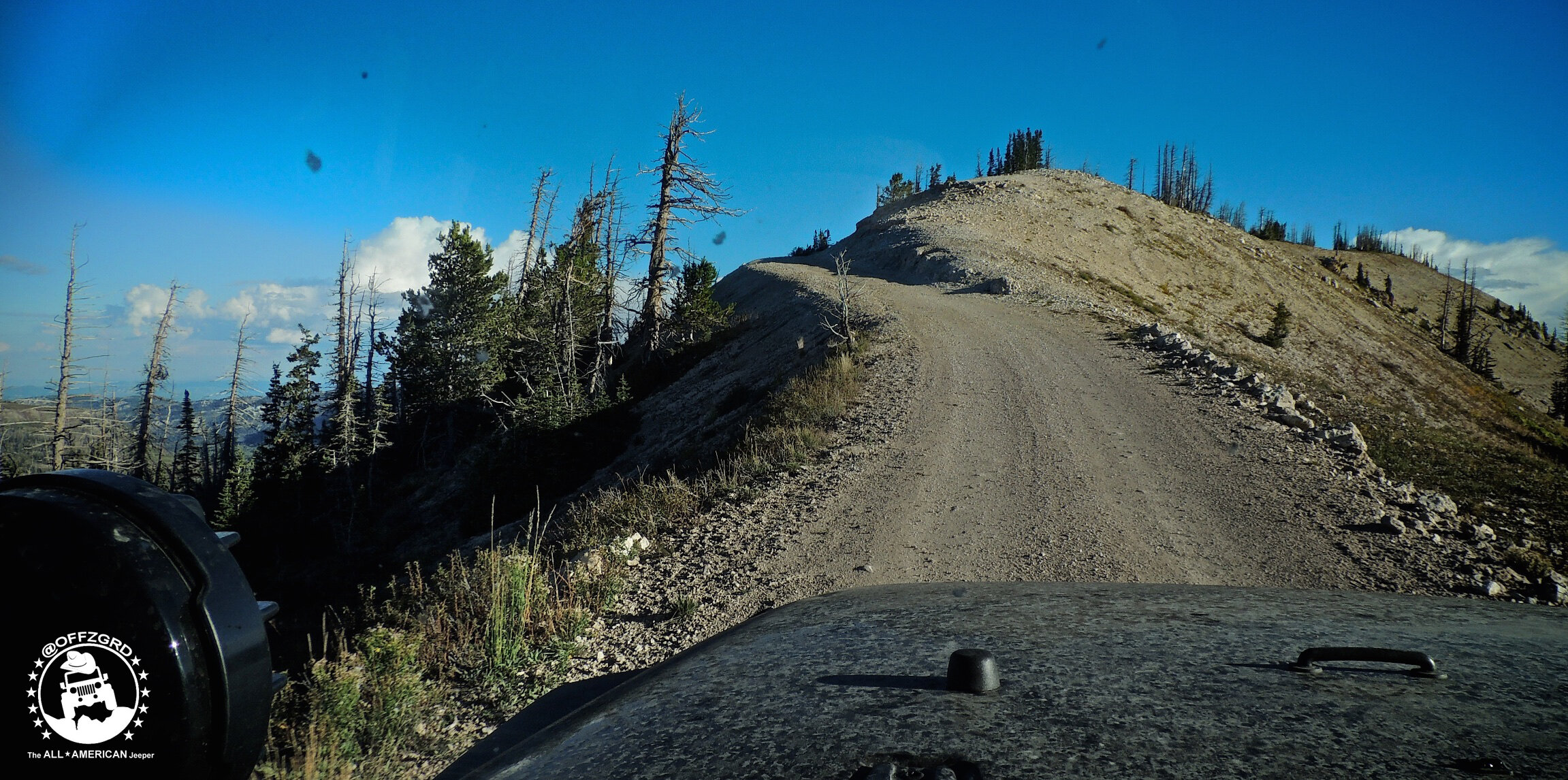
Winding my way through the mountains, I gain elevation as the late-afternoon light wanes in the west. Shadows grow longer and soon there is a sharp contrast in the landscape that seems to reveal its more mysterious nature. Then I come upon a small outpost, a National Forest trailhead for the Arapaheen OHV Trail System. As it turns out, the Arapaheen is a 600-mile matrix that also happens to be friendly to Jeepers and side-by-side UTVs alike.
This is one of those moments when fate seems squarely on my side: I’ve inadvertently stumbled upon a rather extensive trail system that not only leads to some really great byways, but to one of the most famous of them all, Utah’s Skyline Drive (Courtesy of expeditionutah.com - Utah’s preeminent overland Jeeping resource). Located in the heart of the Manti-La Sal National Forest running along the spine of the Wasatch Plateau, you can’t take a wrong turn up here.
For the record, the Skyline Drive is apparently known as one of the “most dangerous roads” in the U.S. But because it’s so treacherous, it’s also one of the most gorgeous – which means it’s absolutely perfect for my Jeep Rubicon, ‘Merica. I’m sure if I’d done a ton of research, gone on offroad forums like expeditionportal.com or forums.off-road.com and called the MLS National Forest Ranger, I could have found this amazing mountain route ahead of time. But discovering it on my own feels like the culmination of a real treasure hunt with the proverbial loot being a clear toss-up between the sunset and the scenery.
The distant echo of a high-caliber rifle puts me on-notice that hunters are active in the area. Being early autumn, I know to pay attention and give hunters their space so as not to spook any game they may be stalking. If you are an avid hunter, Sanpete County is an excellent deer and elk wildlife sanctuary. Make sure to check the local Utah regs on permits and tags before you plan your trip.
As the sun finally dips below the ridgeline, I’m on a keen lookout for a nice spot to pull off the road and keep a low profile. In general, I never park in a place easily visible from any road. Travelling alone, it’s the best way to avoid any unwelcome visitors in the middle of the night.
Turning onto a muddy way-trail, I soon find myself in an aspen grove with an unobstructed view of the alpen-glow settling on a distant red-rock mesa that looks like it’s on fire. This is definitely the spot I’d been hoping to find. So I hop out and quickly gather as much firewood as I can before the night turns to pitch and the moon rises high in the sky. During my search, I discover a perfect place to build the fire – an alcove of red sandstone. Once lit, the flames are like an old friend – always good company no matter how long it’s been since our last visit.
After a solid meal of Stagg Chilli and Aidell’s Italian sausages cooked over a natural-coal BBQ pit, I bed down in my bivy under the stars on top of my roof. Since it also happens to be the beginning of the rut, the chilly midnight air is filled with the shrill screeches of elk preparing to test their might and mettle in an ancient match-up that will decide this season’s breeding rights. I feel privileged to have a front-row seat to this primordial ritual passed down through the crusty crags that surround me and can’t help but wonder if maybe it’s a bit more destiny than luck that brought me to such a special place. Either way, my four-wheeled companion definitely earned herself a couple hours to cool her engine.
When dawn finally breaks, I see just how thick this aspen forest grows. It’s like a veritable wall of white bark! On many of the trunks lining the road, I see initials and names carved along with numerous dates – some of which date back to the 1930’s. I realize I’m not the first, and most certainly will not be the last guy to lay fresh morning tracks on this path. There’s something comforting knowing you’re just a passing part of the history of a place. I can’t say I left a mark here per se, but it sure has made an indelible impression upon me.
Looking back at my trusty maps, I trace Skyline Drive all the way north through the National Forest which is a really welcome surprise. I never expected to find this place much less a route that would carry me the entire length of a mountain range I had originally planned to by-pass at 75mph. What a shame it would have been to miss such a spectacular place simply by allowing technology to take the reins of this epic Jeep adventure.
@OFFZGRD Tip #8: Take the time to take your time. > Slow down; smell the roses. You’ve heard it a million times. This is the time to take notice of all the cool stuff you don’t usually get to see. Who do you think Randi Cooper was back in 1943? Do you think he has an Instagram account I can tag?!
As I make my way out the north end of Skyline Drive and back to I-15N via Rt. 31W outside of Fairview, UT (The self-proclaimed “Gateway to Skyline Drive”), I reflect on how relatively easy it is to get off the grid with a little sense of adventure. There’s one lesson Jeeping has taught me over and over again and I get to apply it to every day of my life: Not every road leads where you want to go, but some just might take you exactly where you wanna be!
Curious how I got my new “paint job” and how the rest of the trip up to the ranch went? Here’s a preview of coming attractions…
Follow my other Jeeping adventures at DanSmargPhotography.com
and on Instagram
See you around the next bend…


